A snowy Sunday that isn't -30
The extreme cold snap in Ottawa has ended and temperatures are forecast to keep rising to well above seasonal norms.
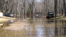
Environment Canada's weather forecast for Ottawa calls for 2 to 4 cm of snow through the day with a risk of freezing drizzle as the temperature approaches the freezing mark. The high is -1 C, or 19 degrees warmer than the high on Saturday.
The average high for this time of the year is around -5 C and the average low is around -15 C. The temperature Sunday rose overnight from -21 C at midnight to -17 C at 7 a.m.
The snow should end around midnight. Overnight expect a few clouds and some lingering flurries. The low is -9 C.
Monday is looking sunny with a high of -6 C.
Tuesday's forecast calls for a high of 1 C with a good chance of snow. Wednesday could see a bit of sunshine with a high of 0 C.


CTVNews.ca Top Stories

King Charles' cancer treatment progressing well, says Buckingham Palace
King Charles III’s doctors are 'sufficiently pleased' with his cancer treatment and he is expected to return to public-facing duties, Buckingham Palace announced on Friday.
Orca calf that was trapped in B.C. lagoon for weeks swims free
An orca whale calf that has been stranded in a B.C. lagoon for weeks after her pregnant mother died swam out on her own early Friday morning.
AFN chief says Air Canada offered a 15% discount after her headdress was mishandled
After the Assembly of First Nations' national chief complained to Air Canada about how staffers treated her and her ceremonial headdress on a flight this week, she says the airline responded by offering a 15 per cent discount on her next flight.
Regina police officer injured after being accidentally shot by fellow officer's gun
An investigation is underway after a Regina police officer was accidentally shot by a fellow officer’s gun during the search of a house early Friday morning.
Sophie Gregoire Trudeau on navigating post-political life, co-parenting and freedom
Sophie Gregoire Trudeau says there is 'still so much love' between her and Prime Minister Justin Trudeau, as they navigate their post-separation relationship co-parenting their three children.
DEVELOPING
DEVELOPING Bird flu outbreaks: WHO weighs in on public health risk
The current overall public health risk posed by the H5N1 bird flu virus is low, the World Health Organization said on Friday, but urged countries to stay alert for cases of animal-to-human transmission.
Taylor Swift dons Montreal designer's dress in 'Fortnight' video
A pair of Montreal designers' work has now been viewed over 41 million times. Taylor Swift dons a Victorian throwback black gown in her latest music video, 'Fortnight', designed by UNTTLD due Simon Belanger and Jose Manuel Saint-Jacques.
From faulty kids' cribs to flammable kids' bathrobes, here are the recalls of the week
Health Canada issued recalls for various items this week, including kids’ bathrobes, cribs and henna cones.
Island near Mull of Kintyre for sale for US$3.1 million
An idyllic 453-acre private island is up for sale off the west coast of Scotland and it comes with sandy beaches, puffins galore, seven houses, a pub, a helipad and a flock of black-faced sheep.
Shopping Trends
The Shopping Trends team is independent of the journalists at CTV News. We may earn a commission when you use our links to shop. Read about us.


Atlantic
-

First court appearance for boy and girl charged in death of Halifax 16-year-old
A girl and a boy, both 14 years old, made their first appearance today in a Halifax courtroom, where they each face a second-degree murder charge in the stabbing death of a 16-year-old high school student.
-
Historic church in Bridgetown, N.S., destroyed by fire
A church in Bridgetown, N.S., has been destroyed by a Friday morning fire.
-
King Charles' cancer treatment progressing well, says Buckingham Palace
King Charles III’s doctors are 'sufficiently pleased' with his cancer treatment and he is expected to return to public-facing duties, Buckingham Palace announced on Friday.
Toronto
-

'Extremely traumatizing:' Boy, 11, struck by transport truck in Etobicoke
An 11-year-old boy struck by a transport truck in Etobicoke on Friday morning suffered critical injuries and is receiving treatment at a Toronto trauma centre, police say.
-
'I was scared': Ontario man's car repossessed after missing two repair loan payments
An Ontario man who took out a loan to pay for auto repairs said his car was repossessed after he missed two payments.
-
Man seriously injured on Toronto subway tracks while fleeing police: TPS
A man has been transported to hospital in serious condition after police say he jumped on the subway tracks at Sherbourne Station while attempting to flee from officers.
Montreal
-

Investigation underway after worker dies at Port of Montreal
Officials with Quebec's workplace safety board are being sent to the Port of Montreal on Friday after a worker was killed on the job.
-
Body of Quebec man who died in Cuba found in Russia, family confirms
A Montreal-area family confirmed to CTV News that the body of their loved one who died while on vacation in Cuba is being repatriated to Canada after it was mistakenly sent to Russia.
-
Taylor Swift dons Montreal designer's dress in 'Fortnight' video
A pair of Montreal designers' work has now been viewed over 41 million times. Taylor Swift dons a Victorian throwback black gown in her latest music video, 'Fortnight', designed by UNTTLD due Simon Belanger and Jose Manuel Saint-Jacques.
Northern Ontario
-

Northern Ont. hunters fined $8,500 for illegal moose hunt
Two hunters from North Bay, Ont., and a third from Temagami pled guilty recently to offences they committed during a 2022 moose hunt.
-
Fire victims in Timmins say thieves have stolen their personal belongings
A month after an accidental fire forced more than 100 people out of their apartments at the Empire Complex in Timmins, residents are now dealing with being victims of theft.
-
'Too young to have breast cancer': Rates among young Canadian women rising
Breast cancer rates are rising in Canada among women in their 20s, 30s and 40s, according to research by the University of Ottawa (uOttawa).
Windsor
-

Windsor police seize $120,000 in drugs
Windsor police have arrested two people after seizing $120,000 in illegal drugs.
-
Former high school teacher facing another trial
A former high school teacher who just finished one trial is now facing another.
-
Riverside, Seminole and Ouellette lane restrictions planned
The City of Windsor is letting the public know about lane restrictions on three busy streets.
London
-

Portion of Highway 401 reopens following fatal crash
A fatal crash in Thames Centre closed down a portion of Highway 401 westbound. Around 2:15 a.m., first responders were called to westbound lanes of the highway between Culloden and Putnam Roads for a two-vehicle crash.
-
Two people taken to hospital after Oxford County crash
An unknown number of people have been taken to hospital following a crash in Oxford County. OPP are on scene of the two-vehicle crash at 37th Line and Road 74 in Zorra.
-
London police searching for shopping centre arson suspects
London police are asking for the public's help locating four suspects in an arson investigation.
Kitchener
-

57-year-old pedestrian in hospital after hit-and-run crash in Cambridge: WRPS
A 57-year-old man was transported to hospital with serious injuries after police say he was involved in a hit-and-run collision in Cambridge.
-
Driver hits woman pushing 3-month-old baby in stroller
An elderly Guelph driver has been charged after hitting a woman pushing a stroller.
-
Another fire at old Robson Lang building in Kitchener
Flames could be seen coming from a vacant leather factory in Kitchener once again late Thursday night.
Barrie
-

Pedestrian struck by CP train in Alliston
A man is in serious condition after being struck by a train near Alliston.
-
Police warn of caller ID phone scams
Faking a caller identity has never been so easy.
-
Garage fire sends resident to hospital
A small garage fire sent a resident to the hospital in Huntsville.
Winnipeg
-

'Deep ignorance': Calls for Manitoba trustee to resign sparked after comments about Indigenous people and reconciliation
A rural Manitoba school trustee is facing calls to resign over comments he made about Indigenous people and residential schools earlier this week.
-
AFN chief says Air Canada offered a 15% discount after her headdress was mishandled
After the Assembly of First Nations' national chief complained to Air Canada about how staffers treated her and her ceremonial headdress on a flight this week, she says the airline responded by offering a 15 per cent discount on her next flight.
-
Winnipeg councillor apologizes for 'bicycle Nazi' comment
A Winnipeg city councillor has formally apologized for using the term “bicycle Nazis” to describe a cycling advocacy group at a meeting earlier this month.
Calgary
-

Stabbing at Calgary Value Village under investigation by police
Calgary police took two people into custody on Friday after a stabbing in the community of Haysboro.
-
Calgary police investigate shooting in Valleyfield industrial area
Calgary police are investigating a shooting reported in the Valleyfield industrial area on Friday.
-
Calgary man sentenced to 30 months after downtown stabbing spree
A Calgary man has been sentenced to 30 months in prison for his role in a downtown stabbing spree last year that sent multiple people to hospital.
Edmonton
-

Brett Kissel curse? Radio host starts petition to stop singer from performing anthem at Oilers playoff games
An Edmonton radio host created a petition to stop country music singer Brett Kissel from performing the anthem at Oilers playoff games – and Kissel signed it.
-
Child sexual exploitation charges laid against Alberta RCMP officer
An Alberta RCMP officer has been charged with child sexual exploitation offences.
-
Artistic Oilers fans churning out best work during motivating playoff run
The Edmonton Oilers' playoff run is inspiring the team's most creative fans.
Regina
-

Regina police officer injured after being accidentally shot by fellow officer's gun
An investigation is underway after a Regina police officer was accidentally shot by a fellow officer’s gun during the search of a house early Friday morning.
-
Inquest for Regina teen found unresponsive in creek 9 years ago set for May
A public inquest into the death of a Saskatchewan teenager who was found unresponsive in a creek east of Regina in 2015 will take place in May.
-
Sask. RCMP make 2 arrests in connection to Oxbow area homicide
RCMP have made two arrests in connection to a homicide investigation in southeast Saskatchewan.
Saskatoon
-

Blades, Warriors prepare for first all Sask. conference final in 31 years
For the first time since 1993 two Saskatchewan teams will face each other in the Western Hockey League’s (WHL) Eastern Conference Final as the Moose Jaw Warriors and Saskatoon Blades get their third round series underway Friday night
-
Four people arrested after attempted armed robbery in Saskatoon
Four people, including two teen girls, were arrested and charged after an attempted armed robbery on Thursday evening.
-
Council votes for bike safety improvements at corner where cyclist was killed
Saskatoon city council is making road safety improvements following the death of a cyclist at a busy intersection last year.
Vancouver
-

Orca calf that was trapped in B.C. lagoon for weeks swims free
An orca whale calf that has been stranded in a B.C. lagoon for weeks after her pregnant mother died swam out on her own early Friday morning.
-
'Many witnesses' in area during deadly stabbing in White Rock, B.C., investigators say
Homicide detectives investigating a fatal stabbing in White Rock, B.C., say there were several witnesses in the area during the altercation between the 26-year-old victim and the perpetrator who remains at large.
-
Vancouver police seek witnesses after crash leaves man with life-threatening injuries
Police in Vancouver are appealing for witnesses to come forward after a serious crash Thursday left one man in hospital with life-threatening injuries.
Vancouver Island
-
Orca calf that was trapped in B.C. lagoon for weeks swims free
An orca whale calf that has been stranded in a B.C. lagoon for weeks after her pregnant mother died swam out on her own early Friday morning.
-
'Many witnesses' in area during deadly stabbing in White Rock, B.C., investigators say
Homicide detectives investigating a fatal stabbing in White Rock, B.C., say there were several witnesses in the area during the altercation between the 26-year-old victim and the perpetrator who remains at large.
-
Opposition BC United seeks to prevent convicted dangerous offenders from name changes
British Columbia's Opposition leader says community safety should come before protection of privacy rights for dangerous people.
Kelowna
-

B.C. man rescues starving dachshund trapped in carrier: BC SPCA
An emaciated dachshund is now recovering thanks to a Good Samaritan who found the pup near a biking trail in Kelowna, according to the BC SPCA.
-
Search crews called in after missing Kelowna senior's truck found
Search and rescue crews have been called in after a vehicle belonging to a missing senior was located near a rural intersection outside of Kelowna Tuesday.
-
Homicide investigation underway after body found near Kelowna, B.C.
Major crime detectives in British Columbia are investigating a suspected homicide after a body was found in a remote area southeast Kelowna over the weekend.


