Winter storm could dump 25 to 40 cm of snow on Ottawa Monday
A major winter storm could bury Ottawa with 25 to 40 cm of snow as thousands of students and teachers return to class on Monday for the first time since the Christmas break.
"We are confident that there is going to be a significant snowfall," Environment Canada operational meteorologist Daniel Liota said.
Environment Canada has issued a winter storm watch for Ottawa, with 25 to 40 cm of snow expected Sunday night and Monday.
"Right now, the system is still on track to arrive early Monday morning," said Liota in an interview with CTV News Ottawa on Saturday. "The snow will really be heaviest kind of mid-morning into at least the early part of the afternoon before diminishing throughout the evening hours."
Environment Canada says Ottawa could see 2 to 5 cm of snow per hour Monday morning and afternoon.
The 25 to 40 cm of snow on Monday would set a record for greatest snowfall in Ottawa on Jan. 17. The current record is 11.7 cm of snow, set back in 1972.
Ottawa has only received 5 cm of snow in January, after 38.6 cm of snow in December.
A winter storm watch is also in effect for Kingston, Brockville, Leeds and Grenville, Cornwall-Morrisburg, Smiths Falls, Prescott and Russell, Renfrew-Pembroke and Barry's Bay. All areas could see 25 to 40 cm of snow.
Liota says it is too soon to predict the exact snowfall and track for the storm.
"The concern that we're facing is the western edge of the snow, on the backside of the system, it's going to be a very sharp cut off – from rather significant amounts to minor amounts, even next to nothing," said Liota.
"For eastern Ontario, it's seems a pretty safe bet that all areas will see a considerable snowfall – at least in the range of 15 plus centimetres."
The winter storm watch comes as an extreme cold warning remains in effect for Ottawa. A wind chill of minus 35 is expected overnight into Sunday.
Liota tells CTV News Ottawa the snow will provide a reprieve from the cold temperatures, but the cold "will return" on Tuesday and continue through the rest of the month.
"Unfortunately, the reprieve is not very long. It does look the cold returns later this week," said Liota.
"We do see some pretty strong signals that we're going to see at least another shot or two of very cold air before the end of this month. So it's going to be a very cold end to January."
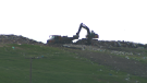
SNOWCLEARING OPERATIONS
The city of Ottawa says its equipment and operators will be ready for deployment as required when the snow starts to fall.
"After experiencing a few events with low accumulations, it seems like we are making up for lost time with this winter wallop," said the city on its website.
"The Roads and Parking Services Team is tracking a significant snowfall that is expected to reach Ottawa early on Monday, and we may need to declare this as a Significant Weather Event."
During a winter storm, the city will deploy plows to clear major roads, arterials and major collector roads once the snow starts falling.
After the last snowflake falls, the city says the snowclearing operations include:
- Major roads, arterials and major collectors: Within four hours. Roads will not be bare pavement during a storm.
- Minor collector roads: Within six hours
- Residential roads and lanes: Within 10 hours


CTVNews.ca Top Stories

DEVELOPING
DEVELOPING Live updates as Stormy Daniels testifies at Trump hush money trial
Adult film star Stormy Daniels is on the stand a second time Thursday as former U.S. president Donald Trump’s hush money case continues in Manhattan. Follow live updates here.
BREAKING
BREAKING Sheldon Keefe out as head coach of Toronto Maple Leafs
The Toronto Maple Leafs have fired head coach Sheldon Keefe. The team made the announcement Thursday after the Original Six franchise lost to the Boston Bruins in seven games in the first round of the Stanley Cup playoffs.
Bank of Canada says financial system is stable, but risks remain
The Bank of Canada says the Canadian financial system is stable, but risks remain due to debt servicing costs among households and businesses and stretched valuations of financial assets.
Here are the ultraprocessed foods you most need to avoid, according to a 30-year study
Studies have shown that ultraprocessed foods can have a detrimental impact on health. But 30 years of research show they don’t all have the same impact.
Ontario man frustrated after $3,500 paving job leaves driveway in shambles
An Ontario man considering having his driveway paved received a quote from a company for $7,000, but then, another paver in the neighbourhood knocked on his door and offered half that rate.
Why these immigrants to Canada say they're thinking about leaving, or have already moved on
For some immigrants, their dreams of permanently settling in Canada have taken an unexpected twist.
RateMDs violates privacy of health professionals, class-action lawsuit claims
A lawsuit against RateMDs has been given the go-ahead by a B.C. Supreme Court judge who found the claim that the website violates the privacy rights of medical professionals is not 'bound to fail.'
Boeing 737 catches fire and skids off the runway at a Senegal airport, injuring 10 people
A Boeing 737-300 plane carrying 85 people skidded off a runway at the airport in Dakar, Senegal's capital, injuring 10 people, according to the transport minister, an airline safety group and footage from a passenger that showed the aircraft on fire.
Capital gains tax change 'shortsighted' and 'sows division' business groups tell Freeland
Forging ahead with increasing Canada's capital gains inclusion rate 'sows division,' and is a 'shortsighted' way to improve the deficit, business groups are warning Finance Minister Chrystia Freeland.
Shopping Trends
The Shopping Trends team is independent of the journalists at CTV News. We may earn a commission when you use our links to shop. Read about us.


Atlantic
-

Trucker's body found in trailer in Newfoundland after failed police search in Ontario
Ontario Provincial Police are facing tough questions about their search for a missing Newfoundland trucker whose rig was found two weeks ago in Ontario, then sent back to Newfoundland, where his body was found Monday in the trailer.
-
Two-vehicle crash closes section of Hammonds Plains Road: Halifax police
Halifax Regional Police says a two-vehicle crash has closed a section of Hammonds Plains Road Thursday morning.
-
Lack of parking, high traffic keeping some Halifax-area residents away from downtown core: study
A lack of parking, high traffic volumes, affordability and construction are the main reasons some Halifax Regional Municipality (HRM) residents are staying away from the city's downtown core, according to a recent study.
Toronto
-
 BREAKING
BREAKING Sheldon Keefe out as head coach of Toronto Maple Leafs
The Toronto Maple Leafs have fired head coach Sheldon Keefe. The team made the announcement Thursday after the Original Six franchise lost to the Boston Bruins in seven games in the first round of the Stanley Cup playoffs.
-
New legislation aims to 'better safeguard' Ontario student information from being used inappropriately: province
The provincial government says it plans to introduce regulatory changes that aim to “better safeguard” student information from being 'stolen or used inappropriately.'
-
Free parking and mortgage holidays: Developers offering new incentives as Toronto preconstruction condo sales plummet
As preconstruction condo sales in Toronto plummet to levels not seen since the global financial crisis 15 years ago, developers are now turning to more lucrative incentives to try to entice prospective buyers.
Montreal
-

Child hit by cyclist crossing the street to catch school bus in the Plateau
A video circulating on social media of a young girl being hit by a bike has some calling for better safety and more caution when designing bike lanes in the city.
-
Highway 15 collision leaves 1 man dead north of Montreal
An early morning collision on Highway 15 has left one man dead north of Montreal.
-
Flat tire on a highway? Here's why you shouldn't try to fix it
If you're cruising down a highway and realize you have a flat tire, you may want to think twice before stopping to fix it on the side of the road.
Northern Ontario
-
 BREAKING
BREAKING Skeletal remains found in Sudbury identified man missing since 2013
Sudbury police say they have identified the skeletal remains found last week in a wood area of Chelmsford and that no foul play was involved.
-
Here are the ultraprocessed foods you most need to avoid, according to a 30-year study
Studies have shown that ultraprocessed foods can have a detrimental impact on health. But 30 years of research show they don’t all have the same impact.
-
BREAKING
BREAKING Sheldon Keefe out as head coach of Toronto Maple Leafs
The Toronto Maple Leafs have fired head coach Sheldon Keefe. The team made the announcement Thursday after the Original Six franchise lost to the Boston Bruins in seven games in the first round of the Stanley Cup playoffs.
Windsor
-

Ontario family receives massive hospital bill as part of LTC law, refuses to pay
A southwestern Ontario woman has received an $8,400 bill from a hospital in Windsor, Ont., after she refused to put her mother in a nursing home she hated -- and she says she has no intention of paying it.
-
Crash closes portion of road south of Merlin
Police in Chatham-Kent are reporting a road closure due to a crash. The only information available from police is that, “Merlin Road is currently closed south of Merlin."
-
Section of Riverside Drive in Tecumseh closed until 2025
Construction on a portion of Riverside Drive in Tecumseh means the road will be closed from now until early next year.
London
-

More than 150 townhomes in northeast London have lost mail service due to off-leash dog
‘It’s a rough situation.’ Townhome residents on Briarhill Avenue have been without mail delivery for about two months.
-
One person in custody after heavy police presence in Ingersoll
One person has been taken into custody following a police presence near Ingersoll on Wednesday night. Police had surrounded a motel for what was described as an, "investigation in relation to a wanted party."
-
No injuries reported after Wednesday evening crash
No injuries were reported after a two-vehicle crash in London Wednesday evening. The incident happened in the 900 block of Oxford Street near Glasgow Street east.
Kitchener
-

One person in custody after heavy police presence in Ingersoll
One person has been taken into custody following a police presence near Ingersoll on Wednesday night. Police had surrounded a motel for what was described as an, "investigation in relation to a wanted party."
-
Police search for missing child from Waterloo
Waterloo regional police are asking for help finding a missing child from Waterloo.
-
Long-time CKCO personality, Janine Grespan, dies at 63
A broadcaster familiar to many CTV News watchers has died at the age of 63.
Barrie
-

Barrie mayor pushing for more speed cameras
Barrie's mayor is pushing for more photo radar cameras to help curb speeding in the City.
-
Driver suffers life-threatening injuries after two-motor vehicle collision
One person was critically injured in a two-motor vehicle crash in New Tecumseth, Ont.
-
Barrie business owner fed up over repeated break-ins since opening
A small business owner in Barrie is fed up after his establishment has been the target of crime multiple times since opening in 2019.
Winnipeg
-
Court to hear about search for remains as Winnipeg murder trial enters second day
A courtroom in Winnipeg is expected to hear testimony today about the search for the remains of the four victims of Jeremy Skibicki.
-
Last-ditch effort to keep St. Boniface pool open voted down by city committee
A last-ditch effort to keep a St. Boniface pool open for another year may have gone down the drain for good.
-
Fire forcing Manitoba high school students to finish year off-site
A major fire is forcing students at a southern Manitoba high school to finish the school year off-site.
Calgary
-

Alberta man to be sentenced for 2022 impaired driving crash that killed Calgary couple
An Alberta man who admitted to being under the influence of fentanyl and pleaded guilty to dangerous driving causing the 2022 deaths of Macy Boyce and Ethan Halford is scheduled to receive his sentence Thursday.
-
10 things to do in Calgary this weekend
Ten things happening in Calgary this weekend.
-
Council receiving rezoning recap ahead of final vote
After the city's largest public hearing ever wrapped up Monday, rezoning will be the focus once again at city hall as councillors receive a recap presentation summarizing what everyone said.
Edmonton
-

Canucks score four unanswered goals to edge Oilers in Game 1 of series
Conor Garland's snapshot with five-and-a-half minutes left in the third period capped a three-goal run in a five-minute span, lifting the Vancouver Canucks to a 5-4 win over the Edmonton Oilers in Game 1 of their second-round National Hockey League playoff series.
-
WEATHER
WEATHER Josh Classen's forecast: Warmest days of the year (so far)
Sunny and warm for the next few days in Edmonton and across much of central and northern Alberta.
-
Bank of Canada says financial system is stable, but risks remain
The Bank of Canada says the Canadian financial system is stable, but risks remain due to debt servicing costs among households and businesses and stretched valuations of financial assets.
Regina
-

Sask. education minister says teachers' vote results could lengthen school year
Saskatchewan's education minister is being accused of trying to influence a teachers vote after saying he's not ruling out extending the school year should educators reject his offer and take job action.
-
Regina police hope new biometric monitoring system will save lives in detention facility
The Regina Police Service says it is the first in Saskatchewan and possibly Canada to implement new technology in its detention facility that will offer real-time monitoring of detainees’ vital health metrics.
-
Here's a complete timeline of the Saskatchewan teachers labour dispute
The dispute between Saskatchewan educators and the province is rapidly approaching one year in length. It's a fight that's seen a war of words waged over social media, teachers battling extreme cold on the picket line and massive disruptions for the province's student population.
Saskatoon
-

'Hours, not days': Concerns around enforcement grow in Sask. for roadside cannabis testing
Concern is growing around roadside THC testing, cannabis use and driving in Saskatchewan.
-
Sask. education minister says teachers' vote results could lengthen school year
Saskatchewan's education minister is being accused of trying to influence a teachers vote after saying he's not ruling out extending the school year should educators reject his offer and take job action.
-
'Written off': Sask. woman says her brother, who had Down syndrome, fell through the cracks
Tara Jo Kadlec has been advocating for better care for her brother Cory for years.
Vancouver
-

Rivers recede as B.C. faces prospect of 'unfamiliar territory' for drought
Parts of British Columbia will likely enter "unfamiliar territory" with drought if they see another hot, dry summer, says the head of the province's River Forecast Centre.
-
East Vancouver house of 'little or no value' listed for $1.65 million
If you’re looking for a prime example of how expensive land is in Vancouver, regardless of the state of the building that stands on it, look no further.
-
Man arrested after senior pepper sprayed during Facebook Marketplace sale: North Vancouver RCMP
More than a year after a senior was pepper sprayed in North Vancouver during an attempted Facebook Marketplace sale, police say they've arrested a suspect.
Vancouver Island
-

'Sophisticated' cyberattacks detected on B.C. government networks, premier says
There has been a "sophisticated" cybersecurity breach detected on B.C. government networks, Premier David Eby confirmed Wednesday evening.
-
Victoria cyclist Riley Pickrell bloodied in crash at Giro d'Italia
Canadian riders Michael Woods and Riley Pickrell are out of the Giro d'Italia.
-
RateMDs violates privacy of health professionals, class-action lawsuit claims
A lawsuit against RateMDs has been given the go-ahead by a B.C. Supreme Court judge who found the claim that the website violates the privacy rights of medical professionals is not 'bound to fail.'
Kelowna
-
Kamloops RCMP issue public warning about 2 men allegedly at centre of 'organized crime conflict'
After four targeted shootings in four days, Mounties in Kamloops are taking the unusual step of warning the public about two men they believe are likely to be targeted in future violent incidents.
-
Community mourns thousands of fish lost as B.C. drought risk looms again
Images of steelhead and trout flicker over long sheets of paper, brought to life in blue and green crayon rubbings by the thousands.
-
4th targeted shooting in as many days in Kamloops: RCMP
A man was taken to hospital with non-life-threatening injuries after a shooting in Kamloops Monday evening, the fourth incident police say is part of an ongoing drug conflict playing out on the city's streets.


