NEW THIS MORNING
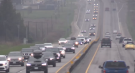
Ottawa will see a return to colder temperatures and snow after a warm streak last week.
Environment Canada says temperatures are expected to be near the freezing mark throughout the week, with flurries expected to fall starting Monday and into Wednesday.
Monday's forecast shows a few flurries ending this afternoon then remaining cloudy throughout the day. Westerly winds at 20 km/h are expected, gusting to 40 km/h in the morning.
The daytime high will be 3 C and -4 C overnight. Overnight wind chill will be -10 C.
Tuesday shows a mostly cloudy forecast with a 40 per cent chance of flurries in the afternoon. Flurries will become heavy beginning late in the afternoon. Snow will continue into the night.
Tuesday's temperatures will be a high of 1 C and a low of -6 C in the evening.
A 60 per cent chance of flurries is expected on Wednesday, but the forecast calls for a sunny week ahead.
Thursday will be sunny with a high of -1 C. Similar conditions are expected on Friday.
The weekend forecast shows sunny conditions with temperatures near the freezing mark.

More than 115 people who viewed the solar eclipse in Ontario earlier this month experienced eye damage after the event, according to eye doctors in the province.
A Sherwood Park family says their new house is uninhabitable. The McNaughton's say they were forced to leave the house after living there for only a week because contaminants inside made it difficult to breathe.
A man has been handed a lengthy hunting ban and fined thousands of dollars for illegally killing a grizzly bear, B.C. conservation officers say.
The B.C. NDP has asked the federal government to recriminalize public drug use, marking a major shift in the province's approach to addressing the deadly overdose crisis.
The Ontario Provincial Police (OPP) says it's investigating an interaction between a uniformed officer and anti-Trudeau government protestors after a video circulated on social media.
An emergency slide fell off a Delta Air Lines jetliner shortly after takeoff Friday from New York, and pilots who felt a vibration in the plane circled back to land safely at JFK Airport.
Sophie Gregoire Trudeau says there is 'still so much love' between her and Prime Minister Justin Trudeau, as they navigate their post-separation relationship co-parenting their three children.
George Mallory is renowned for being one of the first British mountaineers to attempt to scale the dizzying heights of Mount Everest during the 1920s. Nearly a century later, newly digitized letters shed light on Mallory’s hopes and fears about ascending Everest.
A loud explosion was heard across Hamilton on Friday after a propane tank was accidentally destroyed and detonated at a local scrap metal yard, police say.
The Shopping Trends team is independent of the journalists at CTV News. We may earn a commission when you use our links to shop. Read about us.

A girl and a boy, both 14 years old, made their first appearance today in a Halifax courtroom, where they each face a second-degree murder charge in the stabbing death of a 16-year-old high school student.
Cape Breton Regional Police found a dead body in Sydney, N.S., Thursday evening.
A popular chef, who is fighting a battle against an aggressive form of cancer, is getting support from her community.

Ontario is now home to an invasive and toxic worm species that can grow up to three feet long and can be dangerous to small animals and pets.
More than 115 people who viewed the solar eclipse in Ontario earlier this month experienced eye damage after the event, according to eye doctors in the province.
A loud explosion was heard across Hamilton on Friday after a propane tank was accidentally destroyed and detonated at a local scrap metal yard, police say.

Montreal comic book artists Ben and Ray Lai claim Marvel and Disney are abusing the legal process in the Lai brothers' copyright infringement suit against the industry giants.
The office of Quebec Housing Minister France-Élaine Duranceau prefers to openly ignore journalists' requests.
A couple is breathing a sigh of relief after winning the right to stay in their Verdun apartment.

Two hunters from North Bay, Ont., and a third from Temagami pled guilty recently to offences they committed during a 2022 moose hunt.
Sophie Gregoire Trudeau says there is 'still so much love' between her and Prime Minister Justin Trudeau, as they navigate their post-separation relationship co-parenting their three children.
Ontario Provincial Police responding to a disturbance in West Nipissing this week discovered a conscious person lying in the street.

All the excitement of the NFL Draft has officially descended upon Detroit, with Windsor welcoming the spillover.
A ribbon cutting to celebrate the opening of a new grief support centre on Baseline Road in Windsor marked a bittersweet moment for many at Julien’s House Friday morning.
Windsor police have arrested two people after seizing $120,000 in illegal drugs.

In case you missed it, CTV News London has compiled all the top local stories from this week into one video for your convenience.
Efforts at city hall to get reimbursed by the federal government for costs incurred by asylum seekers might be too late.
Police said they were called to a weapons-related incident on Morning Glory Drive around 1:30 p.m. Friday.

More than a year has passed since the City of Kitchener announced it was pausing community consultations on the future of the Queen Victoria statue in Victoria Park, and there is still no timeline for a resumption of the process.
An investor with ties to apartment buildings across Ontario appears to be connected to 250 Frederick Street in Kitchener.
Ontario’s Minister of Economic Investment, Job Creation and Trade says a number of companies have shown interest in a tract of land the Region of Waterloo is trying to assemble in Wilmot Township.
One person killed in multi-vehicle crash in Innisfil on Friday.
With its Innisfil location’s lease set to expire within the next five years, Gateway Casinos is eyeing a plan to move.
The Ontario Provincial Police (OPP) says it's investigating an interaction between a uniformed officer and anti-Trudeau government protestors after a video circulated on social media.

Nathan MacKinnon and Valeri Nichushkin scored on the power play during a five-goal, third-period outburst and the Colorado Avalanche rallied for a 6-2 victory over the Winnipeg Jets in Game 3 on Friday night.
Parents in Gimli who rely on child care before and after school are sounding the alarm over policy changes coming in September.
Take an illustrated look back at the culinary history of Winnipeg.

Calgary police took two people into custody on Friday after a stabbing in the community of Haysboro.
If you've spent any amount of time scrolling TikTok at 3 a.m. (it's OK -- we all have), you probably know the meme...
It will warm up tomorrow, but it will also be gusty at times.

A cat that jumped from the balcony of a burning building in downtown Edmonton on Thursday afternoon will make a full recovery, building officials say.
A bill that would empower the Alberta government to remove elected municipal officials or strike down local bylaws is an "attack on local democracy," says the capital city's mayor.
As if a 4-0 Edmonton Oilers lead in Game 1 of their playoff series with the Los Angeles Kings wasn't good enough, what was announced at Rogers Place during the next TV timeout nearly blew the roof off the downtown arena.

RCMP have identified 28-year-old Brianna Hayes from Oxbow, Sask. as the victim in an ongoing homicide investigation in the province’s southeast. As a result, police have charged 24-year-old Taylor Japp, also from Oxbow with second degree murder, an RCMP news release said.
Youth in Yorkton can now access a new Lego Therapy program in their community through SaskAbilities.
A Regina police officer was injured after another officer's gun was accidentally fired while conducting a search warrant early Friday morning.

Over six months after Saskatchewan's government announced a significant $90 million investment in social services, the initiative is reportedly making progress.
The Saskatoon Police Service (SPS) and Saskatchewan Coroners Service are investigating after a woman’s body was found at a recycling facility Friday morning.
Four people, including two teen girls, were arrested and charged after an attempted armed robbery on Thursday evening.

J.T. Miller had a goal and assist and the Vancouver Canucks edged the Nashville Predators 2-1 to re-take the lead in their first-round playoff series.
The 36-year-old killed on Highway 5 this week has been identified as Juver Balmore, a husband and father of three young children who worked for CN Rail.
A fire that displaced three families from a townhouse complex in Surrey's Newton neighbourhood Friday afternoon is considered suspicious, local Mounties say.

The B.C. NDP has asked the federal government to recriminalize public drug use, marking a major shift in the province's approach to addressing the deadly overdose crisis.
Saanich council will be discussing a report Monday prepared by Saanich Fire Chief Michael Kaye on the merits of amalgamating the fire departments of Victoria, Oak Bay, Esquimalt and Saanich.
When Art Kinarthy embarked upon this quest, he never could have imagined where it would ultimately lead.

An emaciated dachshund is now recovering thanks to a Good Samaritan who found the pup near a biking trail in Kelowna, according to the BC SPCA.
Search and rescue crews have been called in after a vehicle belonging to a missing senior was located near a rural intersection outside of Kelowna Tuesday.
Major crime detectives in British Columbia are investigating a suspected homicide after a body was found in a remote area southeast Kelowna over the weekend.