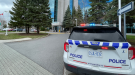
Survey teams confirm weak tornado southwest of Ottawa
A weak tornado touched down in Franktown, Ont., southwest of Ottawa, investigators have confirmed.
Survey teams from the Northern Tornadoes Project at Western University confirmed the finding Thursday afternoon, about 24 hours after severe weather moved across the region. They said damage is still being assessed.
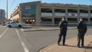
Investigators were also in Ottawa's southwest end on Thursday to investigate damage caused by a "supercell/funnel cloud" during the severe weather. They were following up on damage discovered by storm chaser Connor Mockett, who shared photos on Twitter of damage to a property on Franktown Road, just east of Dwyer Hill Road, and at Riverbend Golf Course in Richmond.
Survey teams are also be looking into damage near Peterborough and Kingston.
"New storm damage found by @ConnorMockettWX in the Franktown area associated with yesterday's supercell/funnel cloud now added to the top of the investigation list for the NTP team on its way to eastern Ontario," the Northern Tornadoes Project said.
A tornado warning was briefly issued for areas south of Ottawa during the dinner hour on Wednesday as the storms swept across the region. The tornado warning stretched from Kemptville to Merrickville-Wolford, Richmond and Metcalfe.
CTV News Ottawa viewers reported hail in the Eganville area.
The storm brought heavy rain, hail and what appeared to be a funnel cloud to areas south of Ottawa.
CTV News Ottawa viewers shared video of a funnel shaped cloud moving in the Ashton area.
"It was pretty dramatic," Dee Murphy Brown said. "We lost our barbecue, our neighbours lost their play structure. We back onto a large horse farm and apparently one of the buildings had come down as well."
Damage was also reported near Brighton in Quinte West.
There are no power outages reported across eastern Ontario on Thursday morning. Hydro Ottawa had reported 3,500 customers without power on Wednesday.
RAIN COMES AS RAINY AUGUST ENDS
Ottawa has received 183.4 mm of rain so far this month. According to the Twitter account YOW_Weather, it's the third wettest August in Ottawa since records began. The record is 204.2 mm, set back in August 1893.
The forecast calls for 10 to 15 mm of rain. Mainly cloudy tonight with a chance of showers. Low 10 C.
Thursday will be mainly cloudy to start the day, with skies clearing in the afternoon. High 20 C.
The outlook for Friday is sunny and a high of 27 C, while Saturday will be sunny with a high of 29 C.
The normal temperatures for this time of year are a high of 22 C and a low of 12 C.


CTVNews.ca Top Stories

BREAKING
BREAKING Parents of infant who died in wrong-way crash on Ontario's Hwy. 401 were in same vehicle
Ontario’s Special Investigations Unit has released new details about a wrong-way collision in Whitby on Monday night that claimed the lives of four people.
Three Quebec men from same family father hundreds of children
Three men in Quebec from the same family have fathered more than 600 children.
'What have we done?' Lawyer describes shock at possible role in Trump's 2016 victory
A lawyer who negotiated a pair of hush money deals at the centre of Donald Trump's criminal trial recalled Thursday his "gallows humor" reaction to Trump's 2016 election victory and the realization that his hidden-hand efforts might have contributed to the win.
B.C. mayor stripped of budget, barred from committees over Indigenous residential schools book
A British Columbia mayor has been censured by city council – stripping him of his travel and lobbying budgets and removing him from city committees – for allegedly distributing a book that questions the history of Indigenous residential schools in Canada.
New scam targets Canada Carbon Rebate recipients
Fake text message and email campaigns trying to get money and information out of unsuspecting Canadian taxpayers have started circulating, just months after the federal government rebranded the carbon tax rebate the Canada Carbon Rebate.
Universities grapple with the complicated politics of campus encampments
Montreal police are facing pressure to move in and dismantle a pro-Palestinian encampment on McGill University campus on Thursday, as a growing number of universities across this country grapple with the tough decision of how to handle the protests.
Conservative MP says Chinese hacking attack targeted his personal email
A Conservative MP is challenging claims by House of Commons administration that a China-backed hacking attempt did not impact any members of Parliament, because the attack was on his personal email.
Loblaw leaders call criticism 'misguided,' say they aren't to blame for high food prices
Loblaw chairman Galen Weston and the company's new CEO are pushing back against critics who blame the grocery giant for soaring food prices, as a month-long boycott of the retailer gets underway.
Heavy police presence at McGill University as counter-protesters assemble opposite pro-Palestinian encampment
A heavy police presence was at McGill University on Thursday morning, as counter-protesters assembled opposite the pro-Palestinian encampment at the school.
Shopping Trends
The Shopping Trends team is independent of the journalists at CTV News. We may earn a commission when you use our links to shop. Read about us.


Atlantic
-
Fourth teen charged with second-degree murder in connection with Halifax student's death
Police say a fourth teenager has been charged in connection with the death of a student in Halifax last week.
-
N.S. Power wants ratepayers to cover $22M bill for last year's storm damages, repairs
Nova Scotia Power has filed an application with the province's Utility and Review Board to have ratepayers cover the cost of last year's storm damage to the tune of $22 million.
-
CBRM Mayor Amanda McDougall-Merrill says she won't run in next election
The mayor of the Cape Breton Regional Municipality says she will not re-offer in October’s municipal election.
Toronto
-
BREAKING
BREAKING Parents of infant who died in wrong-way crash on Ontario's Hwy. 401 were in same vehicle
Ontario’s Special Investigations Unit has released new details about a wrong-way collision in Whitby on Monday night that claimed the lives of four people.
-
Auston Matthews to miss second straight playoff game with Toronto Maple Leafs facing elimination
Auston Matthews will miss the Maple Leafs' must-win Game 6 against the Boston Bruins.
-
One person injured in fire at North York synagogue
A synagogue in North York was badly damaged in a two-alarm fire Thursday morning that left one person injured, and officials are working to determine the cause of the blaze.
Montreal
-

Heavy police presence at McGill University as counter-protesters assemble opposite pro-Palestinian encampment
A heavy police presence was at McGill University on Thursday morning, as counter-protesters assembled opposite the pro-Palestinian encampment at the school.
-
Planets aligned for Quebec astrologer's lottery win
A Montreal astrologer and horoscope writer just got a boost on his retirement budget, after winning Loto-Quebec’s Grande-Vie prize, which comes in the form of $1,000 a day for life.
-
Quebec premier asks police to dismantle camp at McGill University
Quebec Premier Francois Legault has called on the police to dismantle the pro-Palestinian protest encampment on the lower field of McGill University's downtown campus in Montreal.
Northern Ontario
-

Northern Ont. police forced into the river to save intoxicated swimmer
An intoxicated man wearing only his underwear and a lifejacket had to be pulled from the Thessalon River early Wednesday evening.
-
This Canadian restaurant just lowered its prices. Here's how it did it
A Canadian restaurant lowered its prices this week, and though news of price tags dropping rather than climbing sounds unusual, the business strategy in this case is not, according to experts in the field.
-
Sault police executing search warrant for home where two bodies were found
Detectives with Sault police, including members of the forensic identification unit, executed a search warrant Thursday inside a residence on Boundary Road.
Windsor
-
Trucker convicted of importing $29M in meth across Ambassador Bridge
A truck driver has been convicted of importing $29 million in methamphetamine across the Ambassador Bridge in Windsor.
-
Sinkhole fixed on University Avenue
The intersection of University Avenue at Church Street has reopened after crews repaired a large sinkhole.
-
'It’s unfortunate': Vandals cut wires to window washer aerial lift truck
Men in Kilts owner, Ben Snow is frustrated after discovering an aerial lift truck his window washing team had been using at a two-day job near downtown Windsor had been vandalized sometime overnight earlier this week.
London
-

Fatal crash involving off-road vehicle
One person has died following a crash in North Perth late Wednesday night. Around 11:30 p.m. first responders were called to Line 72, east of Perth Road 158 for a passenger vehicle and an off-road vehicle had collided.
-
Witness testifies about being sexually assaulted by others as well as parents
A London, Ont. jury heard evidence that the children of a London family were sexually assaulted by other people besides their parents on different occasions.
-
Railway Museum housing plan 'off track': Neighbours
A petition opposing the sale of lands next to the Elgin County Railway Museum in St. Thomas is gaining 'traction.'
Kitchener
-

Cambridge man may need to tear down retaining wall city made him build
A Cambridge homeowner says the city ordered him to rebuild a retaining wall along his property on Edward Street. Now, he might have to take a section of it down.
-
New Hamburg, Ont. family can't get truck's faulty transmission fixed due to aftermarket attachment
A New Hamburg family is feeling deflated after buying a new Toyota hybrid truck.
-
Shirt stolen from Kitchener memorial
Waterloo regional police are investigating a theft from a cultural display set up at The Healing of the Seven Generations in downtown Kitchener.
Barrie
-

Family of man killed in Wasaga Beach crash breaks silence ahead of trial
The family of Jim Lynne is speaking out for the first time since his death in a crash in Wasaga Beach two years ago as the man accused of drunk driving that night prepares to head to trial.
-
Man charged with attempted murder after assault allegations
Police in Barrie charged one man with attempted murder after an alleged assault sent one individual to a trauma centre with life-threatening injuries on Tuesday.
-
Circus show in limbo as City of Barrie approval goes down to the wire
Publicized as a "spellbinding experience," performers from the French-based Cirque De Paris was left scrambling for a temporary building permit approval on Thursday.
Winnipeg
-

Foodfare employee suspended after ‘violent confrontation’ with customer
An employee at a St. Matthews-area grocery store has been suspended and police are investigating after a confrontation with a customer over the weekend.
-
Osborne Village Starbucks set to close temporarily, no reopening date specified
The Osborne Village Starbucks is set to close temporarily next week.
-
Selkirk bowling captain rolling into her 90s
Strikes and gutters, ups and downs, could define the life of 91-year-old Mary Busch.
Calgary
-

Calgary 'getting better' at talking about domestic abuse, but more work needed: advocate
Calgary police and a local advocacy group are urging citizens to watch for warning signs following a deadly domestic assault in the community of Redstone.
-
Fort Calgary rebranded as The Confluence
In an effort to revitalize itself, Fort Calgary is changing its name and logo to reflect more of the history of the location where it sits.
-
Mentorship program building 'strong foundation' for new entrepreneurs
A mentorship pilot program by Business Link aims to help people starting up small businesses by allowing them to learn from others who have a few years of experience under their belts already.
Edmonton
-

Man 'running around with an axe' smashed Edmonton courthouse glass panes: EPS
Several Edmonton Law Courts glass panes were smashed with an axe Wednesday night, the Edmonton Police Service said.
-
Oilers await second-round opponent, plan to use rest as a weapon
During what they hope is a deep run through the gruelling Stanley Cup playoffs this spring, the Edmonton Oilers will take all the time off they can get.
-
RCMP looking for more victims after Edmonton man charged with child luring, sexual assault
RCMP are looking for additional victims after an Edmonton man allegedly used Snapchat to lure and sexually assault a youth.
Regina
-

'Bad deal for Sask.': NDP want province to publicly oppose potential Viterra takeover
The opposition NDP are calling on the Saskatchewan government to publicly oppose a potential merger of agriculture giants Viterra and Bunge.
-
Sask.'s Boundary Dam carbon capture project underperforming: report
A signature carbon capture and storage project in Saskatchewan continues to miss emissions reduction goals, raising questions about the cost-effectiveness of the technology, according to a report.
-
U of R to hike tuition and fees 4% in latest $283M budget
The University of Regina (U of R) is reporting its first balanced budget in years – with the promise to reinvest in student supports as the institution puts its pandemic related fiscal challenges in the rear view mirror.
Saskatoon
-

An 18-year-old was stabbed on a Saskatoon bus, police say
Saskatoon police are investigating an assault on a city bus after an 18-year-old man was stabbed on Wednesday afternoon.
-
'Healthy, happy calves': Cow gives birth to rare set of quadruplets in Saskatchewan
A Saskatchewan family won the bovine lottery after their cow gave birth to a rare set of quadruplets.
-
Saskatoon police say a man was seriously assaulted for trying to stop a theft
Saskatoon police are asking for the public’s help in investigating a serious assault that occurred on April 24 near a gas station in the 300 block of Confederation Drive.
Vancouver
-

Metro Vancouver police seize several kilos of drugs in raids connected to B.C. gang conflict
Mounties are recommending charges against several people after officers seized more than 10 kilograms of suspected fentanyl, cocaine, methamphetamine and opioid pills during a series of raids in Metro Vancouver.
-
B.C. man convicted of fentanyl trafficking after judge rejects claim drugs belonged to a friend
A B.C. man has been convicted of possessing fentanyl for the purpose of trafficking despite claiming the drugs were not his – a defence the judge said he could not "accept or even entertain."
-
The 2024 Vancouver marathon and 7 other events to check out this weekend
The first weekend of May is a busy one in Vancouver, with a marathon, the start of a documentary film festival, and activities and events for Asian Heritage Month, not to mention a pair of Pearl Jam concerts on either side of a possible (but hopefully unnecessary) Canucks Game 7 at Rogers Arena.
Vancouver Island
-

B.C. man convicted of fentanyl trafficking after judge rejects claim drugs belonged to a friend
A B.C. man has been convicted of possessing fentanyl for the purpose of trafficking despite claiming the drugs were not his – a defence the judge said he could not "accept or even entertain."
-
Metro Vancouver police seize several kilos of drugs in raids connected to B.C. gang conflict
Mounties are recommending charges against several people after officers seized more than 10 kilograms of suspected fentanyl, cocaine, methamphetamine and opioid pills during a series of raids in Metro Vancouver.
-
B.C. launches secondary suite incentive program, with forgivable loans of up to $40K
B.C. has launched its previously announced secondary suite incentive program, with eligible homeowners able to receive thousands of dollars in forgivable loans to construct a rental unit.
Kelowna
-

B.C. breweries take home awards at World Beer Cup
Out of more than 9,000 entries from over 2,000 breweries in 50 countries, a handful of B.C. brews landed on the podium at the World Beer Cup this week.
-
B.C. man rescues starving dachshund trapped in carrier: BC SPCA
An emaciated dachshund is now recovering thanks to a Good Samaritan who found the pup near a biking trail in Kelowna, according to the BC SPCA.
-
Search crews called in after missing Kelowna senior's truck found
Search and rescue crews have been called in after a vehicle belonging to a missing senior was located near a rural intersection outside of Kelowna Tuesday.


