'Near zero' visibility possible in Ottawa Sunday evening as snow falls
A snow squall warning is in effect for Ottawa Sunday, with forecasters saying heavy snow could reduce visibility to "near zero."
"Visibility will be suddenly reduced to near zero at times in heavy snow and blowing snow. Travel is expected to be hazardous due to reduced visibility in some locations," Environment Canada said.
"Snow squall warnings are issued when brief but intense bursts of heavy snow will produce near zero visibilities."
Environment Canada issued a snow squall watch on Sunday morning, which was upgraded to a warning in the late afternoon. The weather forecast for the penultimate day of Winterlude calls for a few flurries in the morning and snow squalls in the afternoon on Sunday with clouds and a high of -2 C.
We're expecting around 5 centimetres of snow Sunday. Another 2 to 4 cm of snow is expected Sunday night with a risk of blowing snow. The overnight low is -15 C.
The National Capital Commission has announced that the Rideau Canal Skateway will close at 6 p.m. this evening only hours after a section between Bank Street and the Pretoria Bridge opened at noon. The overnight snowfall prevented crews from additional flooding of the ice surface and the NCC warned of very poor ice conditions.
"We recommend walking over skating," the NCC said Sunday morning.
The NCC said it would provide an update on skating conditions on Monday morning.
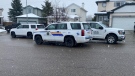
In Gatineau, police said slippery road conditions led to a collision that knocked down a traffic light on Gréber Boulevard between St-René and La Vérendrye.
Family Day Monday's forecast is sunny with a high of -2 C.
Tuesday is looking partly sunny with a high of -3 C.
Warmer weather is in the forecast for midweek, with highs of 3 C expected both Wednesday and Thursday.
Heavy snow for Ottawa Valley, St. Lawrence Seaway
Outside the city, Environment Canada is warning of dangerous travel conditions and heavier snowfall.
Snowfall accumulations of 10 to 15 cm are expected in the Upper Ottawa Valley, while the Brockville area could see 5 to 10 cm.
Heavy snow could reduce visibility on the roads to zero at times, making travel hazardous.
A snow squall warning is in effect in the Kingston area, with lake effect snow squalls continuing through the day before moving south of the area in the evening.
"In addition, southwesterly winds gusting up to 80 km/h will accompany these snow squalls resulting in significantly reduced visibility in blowing snow," Environment Canada says.


CTVNews.ca Top Stories

Liberal MP says she's leaving politics over disrespectful dialogue, threats, misogyny
Liberal MP Pam Damoff says she won't run again in the next federal election, saying she has experienced misogyny, disrespectful dialogue in politics and threats to her life.
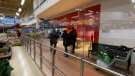
Concerns about Plexiglass prompt inspections at some Loblaws locations in Ottawa
Inspections are underway at more than one Loblaws location in Ottawa after complaints were filed about tall Plexiglass barriers.
Federal employees will be required to spend 3 days a week in the office
Starting in September, public servants in the core public administration will be required to work in the office a minimum of three days a week. The Treasury Board Secretariat says executives will need to be in the office four days per week.
OPP officer said 'someone's going to get hurt' before wrong-way Hwy. 401 crash
As multiple Durham police cruisers were chasing a robbery suspect on the wrong side of Highway 401 Monday night, an Ontario Provincial Police officer shared his concerns, telling a dispatcher, "Someone's going to get hurt."
Ont. woman who faked pregnancy to defraud doulas arrested again on similar charges
Victims of a Brantford, Ont., woman who was sentenced to house arrest earlier this year for defrauding and deceiving doulas say they’re not surprised she’s been apprehended again on similar charges.
Five human skeletons, missing hands and feet, found outside house of Nazi leader Hermann Göring
Archeologists have unearthed the skeletons of five people, missing their hands and feet, at a former Nazi military base in Poland.
Poilievre returns to House unrepentant for calling Trudeau 'wacko,' Speaker not resigning
An unrepentant Pierre Poilievre returned to the House of Commons on Wednesday to pepper the prime minister about his drug decriminalization policies after being booted the day prior for refusing to take back calling Justin Trudeau 'wacko' over his approach to the issue.
Construction begins on LGBTQ2S+ national monument in Ottawa
Shovels have hit the ground for constuction on Canada's LGBTQ2S+ national monument in Ottawa.
B.C. man awarded $5,000 in damages in first-of-it-kind intimate image case
In a first-of-its-kind case, a B.C. tribunal has ruled on a dispute involving the non-consensual sharing of intimate images, awarding damages and issuing orders that the photos be destroyed and taken offline.
Shopping Trends
The Shopping Trends team is independent of the journalists at CTV News. We may earn a commission when you use our links to shop. Read about us.


Atlantic
-

'It's got to make some kind of change': Boycott of Loblaws-owned stores begins
For the next month, thousands of shoppers from across the country plan to get their groceries anywhere other than Loblaws-owned stores. The move is an attempt to get the box chain to lower its prices, as frustration grows over the high price of food.
-
Most wanted fugitive in Canada arrested in Charlottetown, P.E.I.
Local police say officers arrested Michael Bebee, the most wanted fugitive in Canada, in Charlottetown, P.E.I., Tuesday night.
-
Plane overshoots runway at airport in St. John's, N.L., no injuries reported
Investigators from the Transportation Safety Board of Canada were in St. John's, N.L., Wednesday after a plane overshot the main runway at the city's airport.
Toronto
-
OPP officer said 'someone's going to get hurt' before wrong-way Hwy. 401 crash
As multiple Durham police cruisers were chasing a robbery suspect on the wrong side of Highway 401 Monday night, an Ontario Provincial Police officer shared his concerns, telling a dispatcher, "Someone's going to get hurt."
-
Woman in serious condition after being struck by vehicle in Brampton
A female pedestrian has been taken to the hospital after being struck by a vehicle in Brampton.
-
Canada's most wanted fugitive arrested in P.E.I. in connection with Toronto homicide
A suspect in a fatal shooting in Toronto’s east end last summer has been arrested in Charlottetown, just one week after he topped a list of Canada’s most wanted fugitives.
Montreal
-
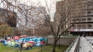
McGill offers 'forum' with protesters after judge dismisses injunction request
A judge has rejected a request from two McGill University students for a court injunction to limit where protesters can go on campus.
-
Montreal investigating separate stabbings
Montreal police were called to investigate two stabbings early Wednesday evening in Rosemont-La-Petite Patrie and Cote-des-Neiges–Notre-Dame-de-Grace.
-
Canadian Airbus A220 workers approve deal, ending lockout fears
Canadian Airbus A220 jet assembly workers approved a five-year contract with more than three-quarters of votes in favor, their union said late on Wednesday, ending fears of a lockout at the planemaker's Montreal-area plant.
Northern Ontario
-

Two people found dead in Sault Ste. Marie
Police in Sault Ste. Marie are investigating two sudden deaths on Boundary Road.
-
Police investigate death in northern Ontario community
The remains of a 44-year-old person were found Tuesday morning on Delamere Road in French River, Ontario Provincial Police said.
-
French River officials hope worst is behind them with flood
French River officials say they’re hopeful things will start to improve now and that they’ve turned a corner from the high water levels on Lake Nipissing, the French River and other waterways going through their municipality.
Windsor
-

‘Unsatisfactory competence’: City Hall denies wrongdoing in wrongful dismissal suit
The City of Windsor has filed its statement of defence following a wrongful dismissal lawsuit filed by a former senior employee.
-
After overseas breakthrough, Windsor researchers one step closer to producing EV batteries which charge in minutes
An overseas manufacturer said it has developed electric vehicle batteries which can be charged in as much time as it takes to grab a coffee from Tim Horton's — and similar batteries are expected to be made by a Windsor-based EV research group sometime this year.
-
Windsor police to crack down on 'unnecessary vehicular noise' in spring campaign
If you like engine revving, loud music and squealing tires, you could be landing yourself a ticket. That’s the message Wednesday from the Windsor Police Service as it launches the 2024 Anti-Noise Campaign.
London
-

'Breaks my heart': Residents react to removal of Canada goose nest, destruction of eggs
Residents who live in the Hyde Park Place apartments in north London, Ont. said they are heartbroken after Old Oak Properties removed two geese nests, containing more than half a dozen eggs.
-
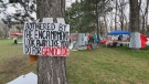
Protestors set up tent encampment on campus, Western University says
As protestors set up tent encampments at universities across Canada and the U.S.in support of Palestine, London, Ont.’s Western University finds itself no exception on Wednesday.
-
South Bruce Council unanimously approves nuclear waste hosting agreement
On Wednesday, councillors with the Municipality of South Bruce voted on a nuclear waste hosting agreement that could change the course of their community forever.
Kitchener
-

Ont. woman who faked pregnancy to defraud doulas arrested again on similar charges
Victims of a Brantford, Ont., woman who was sentenced to house arrest earlier this year for defrauding and deceiving doulas say they’re not surprised she’s been apprehended again on similar charges.
-
WATCH
WATCH Fans flock to Elora, Ont. to see Arnold Schwarzenegger in action
Hollywood heavyweight Arnold Schwarzenegger has caused quite a stir in a small Ontario town this week.
-
Bullet fired into Waterloo business
Waterloo regional police are looking for the person who shot into the window of a Waterloo business.
Barrie
-

Trial set for suspect in 1994 Barrie murder case
The man who police say killed Katherine Janeiro and left her body for friends to find, Robert MacQueen aka Bruce Ellis will stand trial for her murder.
-
Wife brings $267K RVH lottery win home to her husband
A Barrie woman was all smiles after taking home a big lottery win to her husband.
-
Police in Barrie warn residents of possible weapon missing in neighbourhood
Residents in a Barrie neighbourhood are being asked to check their property for suspicious substances or weapons.
Winnipeg
-

High traffic at bustling Winnipeg Costco prompts calls for traffic light
A motion before Winnipeg’s public works committee could make it easier for shoppers who stocked up on bulk packs of toilet paper and chicken breast to exit one of the city’s bustling Costco locations.
-
New report recommends rehab of over 110-year-old bridge, not building new one
Mary Young walks across the Louise Bridge every day.
-
Interprovincial drug bust led by Winnipeg police turns up millions in drugs, cash, luxury goods
More than a dozen people are facing charges, the majority Winnipeggers, after an interprovincial drug bust that turned up millions of dollars in cash, drugs, guns, jewelry and luxury vehicles.
Calgary
-
One in custody after man suffers gunshot wound in Okotoks, Alta., incident
An Okotoks, Alta., man was rushed to hospital on Wednesday afternoon, believed to have been shot in his own home.
-
High River RCMP officer's car struck by passing truck at highway traffic stop
High River RCMP are calling for increased highway awareness after an officer conducting a traffic stop on Highway 2 narrowly escaped being struck by a truck.
-
Province backtracks, will continue to fund low-income transit pass program in Calgary, Edmonton
A day after Calgary's mayor called the Alberta government's decision to pull its funding for the low-income transit pass program "cruel," the province is reversing its decision.
Edmonton
-
Man suffers life-threatening injuries in mid-day stabbing
A man is in life-threatening condition after a Wednesday afternoon stabbing in Edmonton's core.
-
Edmonton fire chief stepping down
Edmonton Fire Rescue Services (EFRS) announced Wednesday morning Joe Zatylny will step down as its chief on May 10.
-
2024 Edmonton debut of e-scooters waiting on city review
At this time last year, e-scooters had been patrolling Edmonton streets for almost a month. This year, they have yet to make their debut -- and likely won't until the end of this month at the earliest.
Regina
-

Sask. to provide financial support to families with children travelling out of province for care
Sask. families who are required to travel outside of the province to access medical care for their children will receive financial support.
-
Former Regina campground to be turned into Indigenous ceremony site
A former campground in Regina will be turned into an Indigenous ceremony site.
-
Rural Sask. highway closed due to semi rollover: RCMP
Weyburn RCMP say no one was injured in a single-vehicle semi rollover on Highway 18 near Beaubier, but the crash did force the closure of Highway 18.
Saskatoon
-

'Healthy, happy calves': Cow gives birth to rare set of quadruplets in Saskatchewan
A Saskatchewan family won the bovine lottery after their cow gave birth to a rare set of quadruplets.
-
Managers must tell new hires about risk of violence at work under new Sask. employment rules
Saskatchewan employers will be required to tell new hires if they face a risk of violence in the workplace and to take actions against it starting on May 17.
-
'Not an easy task': Police begin 'meticulous' search at Saskatoon landfill in Mackenzie Trottier case
Police officers and cadaver dogs have begun searching the Saskatoon landfill for answers in the Mackenzie Lee Trottier case.
Vancouver
-

On Day 1, only about 15% of B.C. dentists have signed on to new federal plan
As of May 1, the new federally-run Canadian Dental Care Plan provides coverage for nearly two million low-income seniors. But finding a provider in B.C. could be tough.
-
First Nations activist reflects on years-long fight against Trans Mountain pipeline expansion
The taps have been turned on for the Trans Mountain pipeline expansion – a national infrastructure project that overcame fierce public opposition, construction delays and cost-overruns that pushed the final bill to more than $34 billion.
-
All provincial employees in B.C. directed to change passwords
Every provincial employee is receiving emails or memos directing them to change their passwords immediately, CTV News has learned.
Vancouver Island
-

Gaza protesters at University of Victoria say encampment will stay until demands are met
A pro-Palestinian protest camp has formed at the University of Victoria in solidarity with the people of Gaza and with similar encampments that have sprung up on university and college campuses in opposition to the Israel-Hamas war.
-
'It's a people problem': Unsecured garbage bins continue to attract bears on Bear Mountain
Shauna Owens-Krahn lives on Bear Mountain in Langford. Four times a day she takes her dogs for walks through the trails near her home and carries bear spray, just in case.
-
All provincial employees in B.C. directed to change passwords
Every provincial employee is receiving emails or memos directing them to change their passwords immediately, CTV News has learned.
Kelowna
-

B.C. breweries take home awards at World Beer Cup
Out of more than 9,000 entries from over 2,000 breweries in 50 countries, a handful of B.C. brews landed on the podium at the World Beer Cup this week.
-
B.C. man rescues starving dachshund trapped in carrier: BC SPCA
An emaciated dachshund is now recovering thanks to a Good Samaritan who found the pup near a biking trail in Kelowna, according to the BC SPCA.
-
Search crews called in after missing Kelowna senior's truck found
Search and rescue crews have been called in after a vehicle belonging to a missing senior was located near a rural intersection outside of Kelowna Tuesday.


